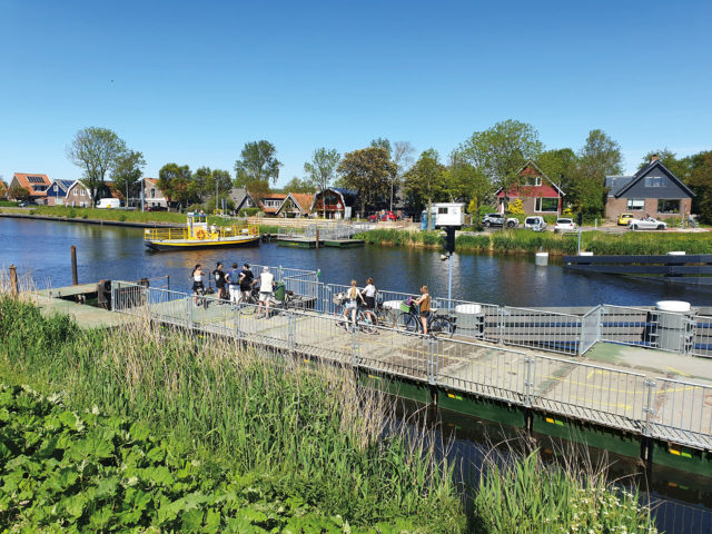
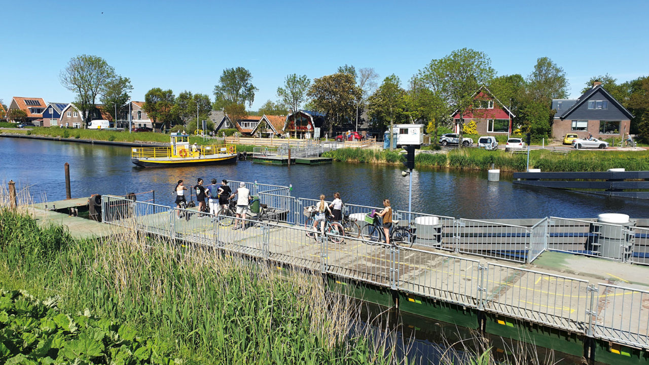
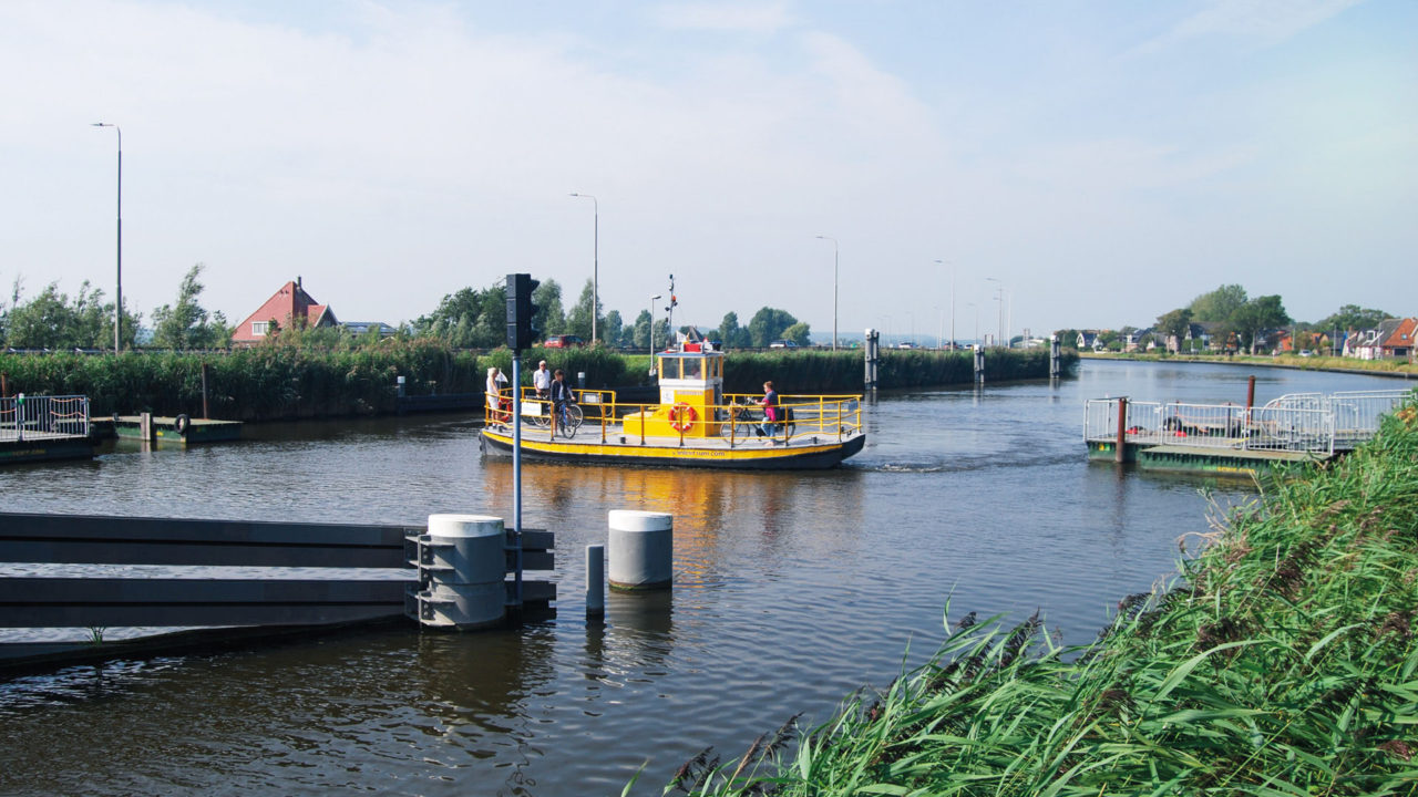
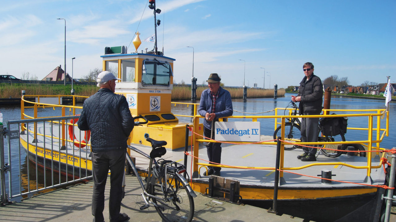
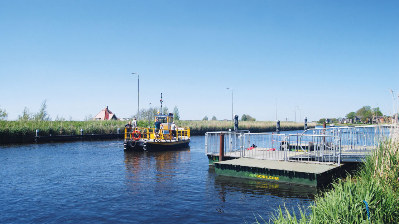
This spring, a boater again sailed into the floating section, once again putting the raft bridge out of service for months. It is now popularly called “the Bridge of Sighs,” or also “the Rekerflop Bridge. The Rekervlot Bridge is an important connection for cyclists and pedestrians crossing the North Holland Canal between Koedijk and Bergen. So after the collision, it was important to find a solution for daily bicycle traffic as soon as possible. Fortunately, Van Schie has ready-made solutions for this type of calamity. Using pontoon structures, it was soon possible to create stable ramps and docking and departure points on both sides of the canal for a temporary ferry. The difference in height on the side of the provincial road – the embankment of the N9 – was especially challenging. Separate docks were constructed for the ferry, originating in Woubrugge.
Projects
'The Bridge of Sighs'
Across the North Holland Canal are five so-called raft bridges. The youngest of the five, the Rekervlot Bridge, is regularly the child of the bill. It is the numerous technical failures and ship collisions that cause a lot of misery.
Collision
The collision against the raft bridge was accompanied by a loud bang, which could be heard in the wider area. Almost every part of the bridge had visible damage. There was a large crack in one of the two rafts, the deck of the bridge was torn loose and all the latch work was broken. The repair will take months. In the meantime, cyclists are happily allowing themselves to be ferried from the two pontoon islands. According to the ferry boss, that’s between 500 and 800 a day!
North Holland Canal
This canal between Amsterdam and Den Helder is a unique waterway: 80 kilometers long, 40 meters wide and 7 meters deep. It was dug in 1824 and at the time was the widest and deepest canal in the world! Created more or less out of necessity. At the time, the Dutch merchant fleet was growing like coal, and VOC ships were getting bigger and bigger. The fully loaded ocean-going ships that had to go to Amsterdam via the Zuiderzee got stuck on the sandbank near Pampus and sometimes lay there for weeks waiting to transfer their cargoes onto smaller ships. Digging a direct connection from Amsterdam to the North Sea (the later North Sea Canal) was not yet dared, as it was not yet technically possible to build a large lock complex. As an alternative, they then dug the canal through North Holland, largely by hand. It took them five years.
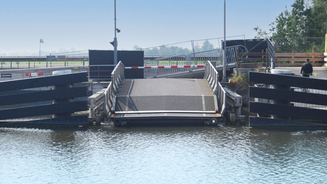
What is a raft bridge?
A raft bridge is a floating movable bridge that opens for navigation by moving horizontally. The bridge consists of an entrance and exit ramp (approach bridges), leading to a raft from both banks. When the bridge opens, this is pulled smoothly under the ramp or turned sideways around a pivot point on an abutment. Usually the floating part consists of two rafts linked together. In some cases, the raft consists of a steel pontoon. Five raft bridges still exist in the Netherlands, all across the North Holland Canal:
- Koedijkervlotbrug (image below).
- Rekervlotbrug
- Burgervlotbrug
- St. Maartensvlotbrug
- Vlotbrug ‘t Zand
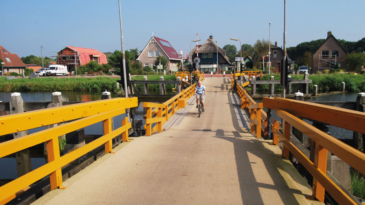
The raft bridges were used because at the time of the construction of the North Holland Canal (1824), it was not yet possible to build bridges with a large span. A ferry could also have been used, but that would cause too much delay for residents. The canal had a width of 40 meters, deliberately chosen because at that width two Navy line ships could pass each other. These are the ships Michiel de Ruyter commanded at the time, such as “the Seven Provinces,” his own ship.
Feel free to drop by for a cup of coffee!
Call us at 0297 – 237537 or email us at info@vanschie.com.